Midday Nowcast: Warm and Muggy with Occasional Showers and Storms
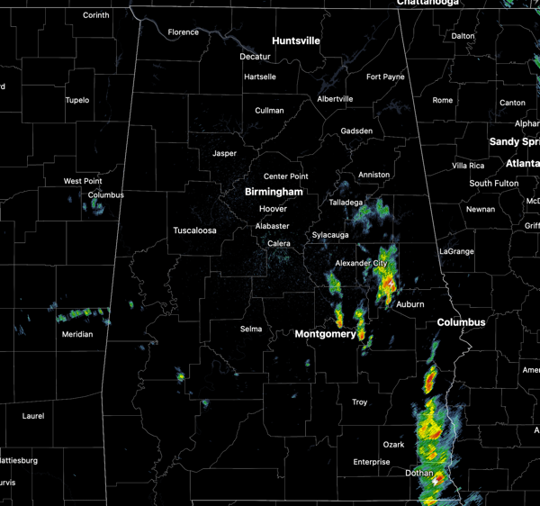
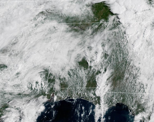
RAINY DAYS AND MONDAYS: I can hear Karen Carpenter singing that 1971 hit today as the wet weekend weather has continued into the new work week. Occasional showers and storms remain in the forecast today and tomorrow as a very slow moving upper-level low continues to allow for the unsettled weather. It will not be raining all the time, but when it is raining, it could be heavy and produce areas of isolated flooding and the flood watch remains in effect through this evening.
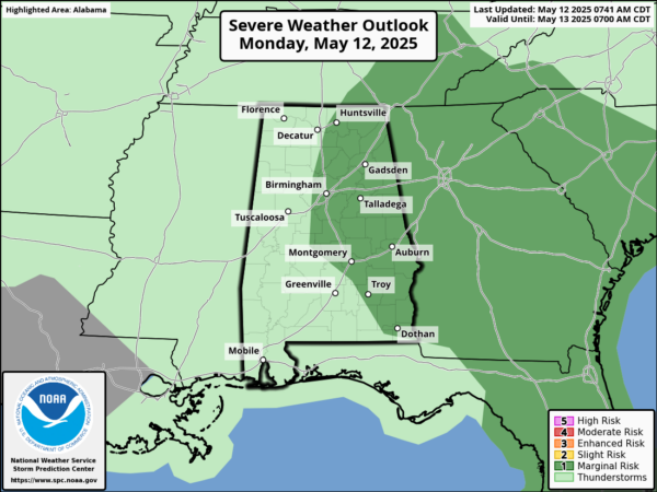
A few strong storms remain possible with gusty winds and some hail possible, but organized severe weather is not expected. It remains warm and muggy with highs in the 70s and we are seeing some peeks of sunshine at times in the mainly cloudy sky.
BIRMINGHAM ALMANAC: For May12th, the average high for Birmingham is 81° and the average low is 60°. The record high is 96° set in 1962, while the record low is 41° set in 1989. We average 0.15” of precipitation on this date and the record value is 1.92” set in 1920.
SUNSHINE RETURNS: The upper low finally begins to lift out of the Southeast by midweek, meaning rain chances will finally begin to decrease. Wednesday will feature a few showers over the northern portions of the state, while the rest of the state should be dry. Expect a mix of sun and clouds with highs returning to the mid-80s. Thursday will be mainly sunny and almost hot with highs in the upper 80s. Most of the day Friday will be very warm and dry, but a few showers and storms could drop into North Alabama late in the day ahead of a cold front.
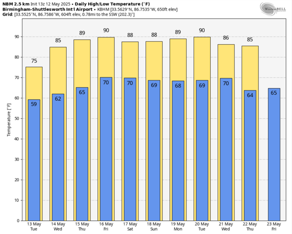
WEEKEND WEATHER: Some rain and thunderstorms are possible at times both days this weekend as the cold front sinks south into the state. It doesn’t look like it will be as wet as this past weekend, but still the umbrella will be needed at times. We should see a mix of sun and clouds both days with highs in the mid to upper 80s. Very warm and muggy weather for sure as air you can wear looks to be here to stay.
NEXT WEEK: It looks like we transition into the standard summer pattern next week with warm and muggy weather with highs in the 80s. For now, no big ticket weather system for Alabama, but each days will feature those random, garden variety, scattered afternoon showers and thunderstorms on a daily basis.
WORLD TEMPERATURE EXTREMES: Over the last 24 hours, the highest observation outside the U.S. was 114.4F at In Guezzam, Algeria. The lowest observation was -100.3F at Concordia, Antarctica.
CONTIGUOUS TEMPERATURE EXTREMES: Over the last 24 hours, the highest observation was 112F at Death Valley, CA. The lowest observation was 25F at Mount Washington, NH.
Category: Alabama's Weather, ALL POSTS, Social Media
About the Author (Author Profile)
Macon, Georgia Television Chief Meteorologist, Birmingham native, and long time Contributor on AlabamaWX. Stormchaser. I did not choose Weather, it chose Me. College Football Fanatic. @Ryan_StinnetSubscribe
If you enjoyed this article, subscribe to receive more just like it.


