A Few Isolated Afternoon Storms Tomorrow Through Friday
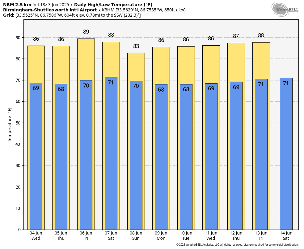
LAZY, HAZY SUMMER DAY: Temperatures are in the 85-90 degree range across Alabama this afternoon with a partly to mostly sunny, hazy sky. No rain on radar, and tonight will be fair with a low in the upper 60s and low 70s.
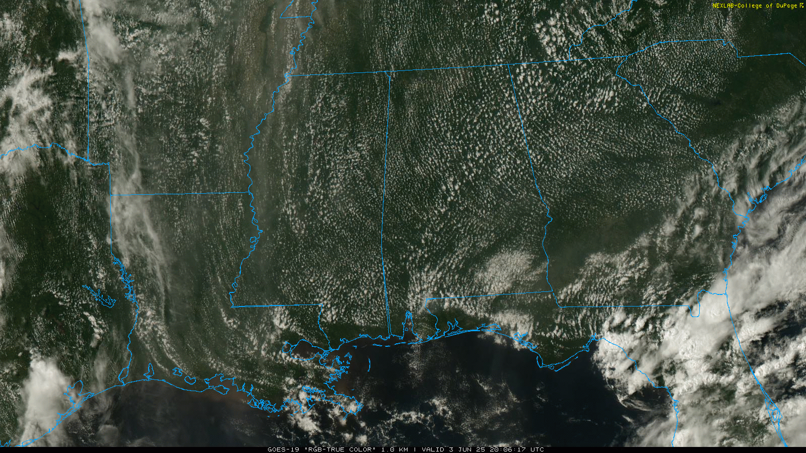
Moisture levels rise a bit tomorrow, and will bring in some risk of scattered afternoon showers or storms… high resolution models suggest the best chance of a passing shower or storm will be over the eastern half of the state. The high tomorrow will remain in the mid to upper 80s.
THURSDAY/FRIDAY: Expect a partly sunny sky both days with widely scattered, mostly afternoon and evening showers and thunderstorms. Highs will remain in the 84-90 degree range, very close to seasonal averages for early June.
THE ALABAMA WEEKEND: A surface front will bring an increase in the number of showers and thunderstorms to the northern half of the state Saturday; SPC has defined a risk of severe storms there due to the potential of hail and strong, gusty winds. We will mention a chance showers and thunderstorms statewide on Sunday; not raining all day but a passing shower or storm is likely. Highs will be in the 80s both days.
NEXT WEEK: For now we will roll with a routine June pattern through the week. Partly sunny days, the risk of mostly afternoon and evening showers and thunderstorms in scattered spots. Highs in the 80s, lows in the upper 60s most mornings. See the video briefing for maps, graphics, and more details.
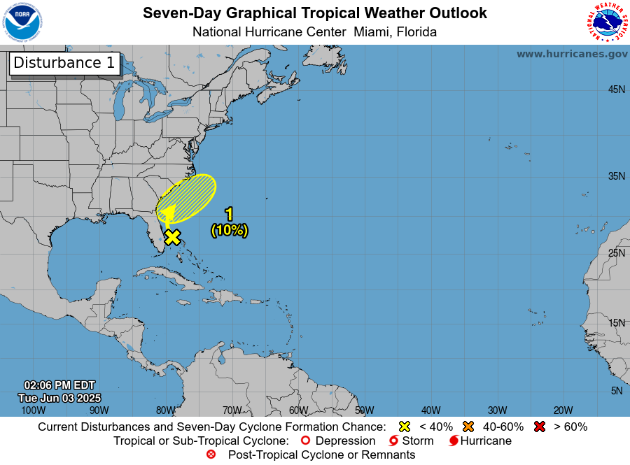
TROPICS: A non-tropical area of low pressure is forecast to form near the southeastern U.S. coast along a frontal boundary during the next couple of days. Environmental conditions appear only marginally conducive for the low to gradually develop some subtropical or tropical characteristics later this week if it forms or moves offshore the coast. The low is forecast to move east of North Carolina over the Atlantic by late Friday or Saturday. The chance of development over the next seven days is only 10 percent. The rest of the Atlantic basin, including the Gulf, is very quiet.
ON THIS DATE IN 1860: Iowa’s infamous Camanche Tornado, likely an F5 storm, kills 92 and injures 200. Every home and business were destroyed. It was one of the most damaging families of tornadoes ever to strike the US and resulted in more farm fatalities than any other tornado except for the Tri-State tornado.
ON THIS DATE IN 1993: Early morning severe thunderstorms dumped huge hailstones across northern Oklahoma. Hail, up to 6 inches in diameter in Enid, went through roofs of homes, damaged three jets at Vance Air Force Base.
Look for the next video briefing here by 6:00 a.m. tomorrow…
Category: Alabama's Weather, ALL POSTS, Weather Xtreme Videos
About the Author (Author Profile)
James Spann is one of the most recognized and trusted television meteorologists in the industry. He holds the AMS CCM designation and television seals from the AMS and NWA. He is a past winner of the Broadcast Meteorologist of the Year from both professional organizations.Subscribe
If you enjoyed this article, subscribe to receive more just like it.


