Isolated Showers Tomorrow; Scattered Storms Thursday/Friday
RADAR CHECK: While most of North Alabama is rain-free this afternoon, we have a few scattered strong thunderstorms over far South Alabama. Heavier ones are producing small hail and gusty winds as they move east/southeast. These will dissipate after sunset tonight.
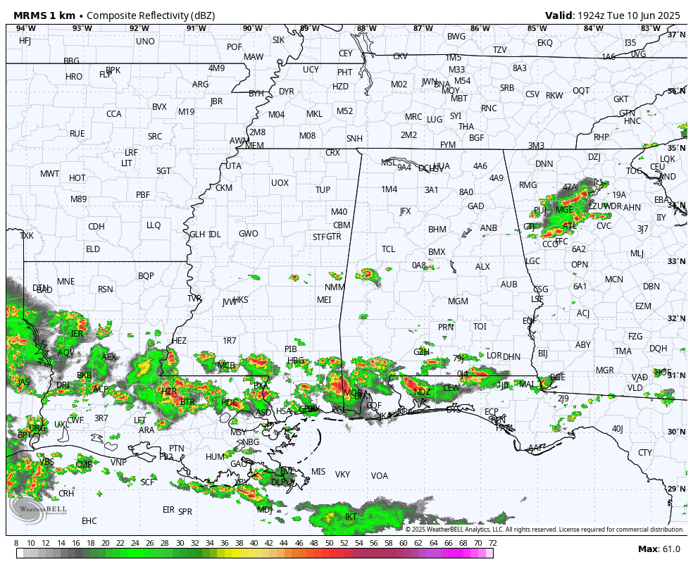
No real change tomorrow; partly sunny with just a few isolated afternoon and evening showers and storms, mainly over the southern counties.
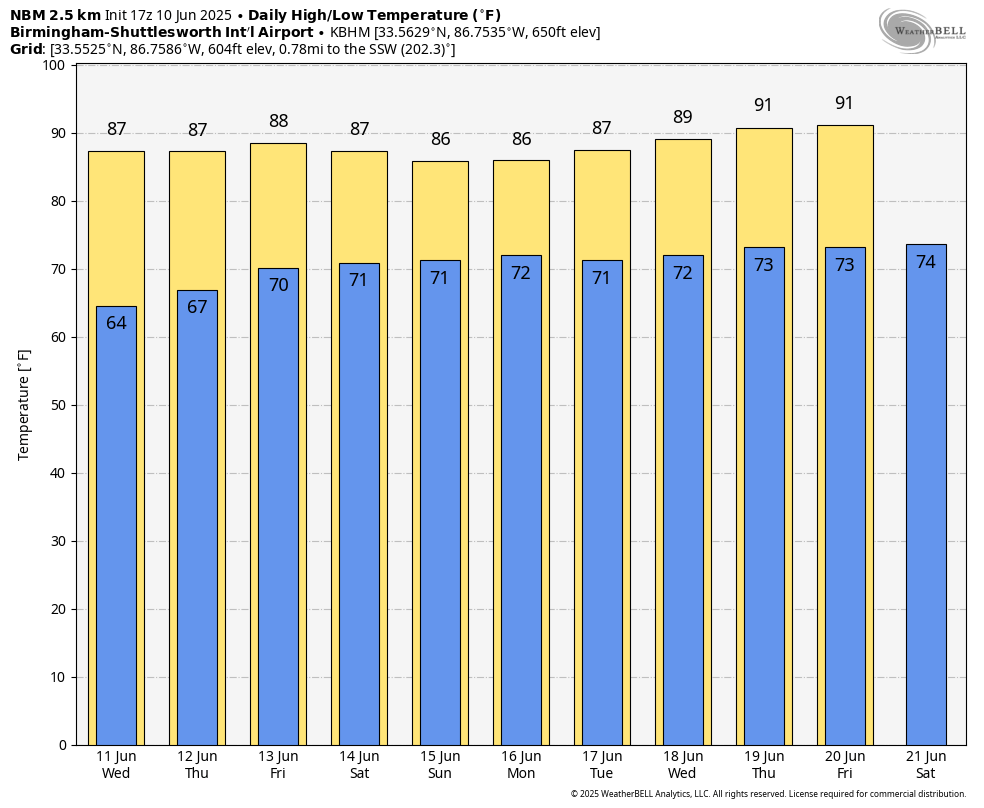
THURSDAY THROUGH THE WEEKEND: Showers and storms will show an increase in coverage late this week and into the weekend, but they will still be scattered, and mostly during the afternoon and evening hours. Each day expect a mix of sun and clouds with highs in the mid to upper 80s, right at. seasonal averages for mid-June. Humidity levels will be very high with a tropical airmass in place across the Deep South. Chance of any one spot seeing rain each day will be in the 40-50 percent range, and most (but not all) of the showers and storms will come from around 2:00 until 10:00 p.m. Organized severe storms are not expected, but any summer storm can produce strong gusty winds and gobs of lightning.
NEXT WEEK: Not much change; pretty routine June weather. Partly sunny, humid, very warm days with “scattered, mostly afternoon and evening showers and thunderstorms” on a daily basis. Highs will be in the 87-91 degree range… See the video briefing for maps, graphics, and more details.
TROPICS: All remains very calm across the Atlantic basin, and tropical storm/hurricane formation is not expected for at least the next seven days.
ON THIS DATE IN 1997: Flash flooding occurred in many locations in Mississippi. Highway 80 and many other streets were flooded in and around Vicksburg. Water engulfed one person’s car, but the person was rescued.
ON THIS DATE IN 2005: Tropical Storm Arlene brought 2-4 inches of rain to the southern 2/3 of Alabama.
Look for the next video briefing here by 6:00 a.m. tomorrow…
Category: Alabama's Weather, ALL POSTS, Weather Xtreme Videos
About the Author (Author Profile)
James Spann is one of the most recognized and trusted television meteorologists in the industry. He holds the AMS CCM designation and television seals from the AMS and NWA. He is a past winner of the Broadcast Meteorologist of the Year from both professional organizations.Subscribe
If you enjoyed this article, subscribe to receive more just like it.


