Summer Mix Of Sun And Storms Over The Weekend
SUMMER DAYS: We have a classic summer mix of sun and scattered showers and thunderstorms for Alabama and the Deep South today and over the weekend. A weak upper trough to the west will bring an uptick in the number of showers, but the overall forecast is pretty routine for June. Look for a mix of sun and clouds each day with scattered showers and storms most active from 2:00 until 10:00 p.m.
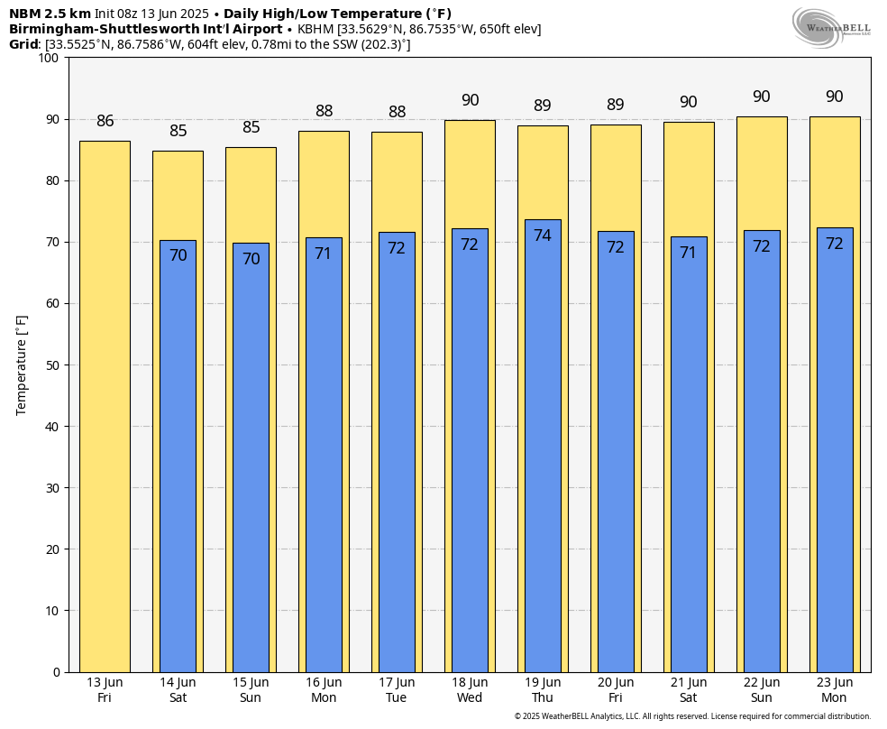
The chance of any one spot getting wet each day is 60-65 percent, and heavier storms will produce strong wind gusts and lots of lightning. Temperatures will be very close to average levels with highs mostly in the upper 80s. We note the average high for Birmingham on June 13 is 88.
NEXT WEEK: The overall pattern stays the same. Partly sunny days with the risk of a passing shower or thunderstorms during the afternoon and evening hours. Afternoon showers should be fewer in number over the latter half of the week as an upper ridge builds across the Deep South. Heat levels will also creep up with highs close to 90 on most days. See the video briefing for maps, graphics, and more details.
TROPICS: The Atlantic basin remains very calm, and tropical storm formation is not expected for at least the next seven days.
ON THIS DATE IN 1976: A deadly tornado moved across parts of the southwestern Chicago, Illinois suburbs killing three people and injured 23 others. The tornado, with winds over 200 mph moved from Lemont to Downers Grove causing $13 million in damage when 87 homes were destroyed, and another 90 were damaged. The tornado passed over the Argonne National Laboratory, peeling part of a roof of the building housing a nuclear reactor.
Look for the next video briefing here by 3:00 this afternoon… enjoy the day!
Category: Alabama's Weather, ALL POSTS, Weather Xtreme Videos
About the Author (Author Profile)
James Spann is one of the most recognized and trusted television meteorologists in the industry. He holds the AMS CCM designation and television seals from the AMS and NWA. He is a past winner of the Broadcast Meteorologist of the Year from both professional organizations.Subscribe
If you enjoyed this article, subscribe to receive more just like it.


