Midday Nowcast: Higher Rain Chances through the Weekend
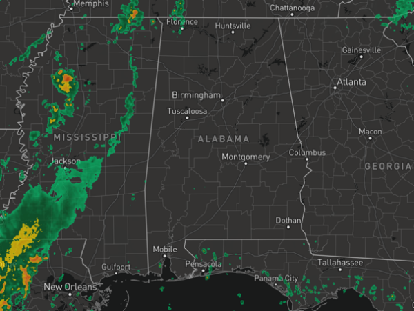
HIGHER RAIN CHANCES: A weak upper trough to our west, along with very high moisture levels will allow for scattered to numerous showers and storms today through Sunday. Rain chances are in the 70-90% range the next three days. It won’t rain all the time and in fact a majority of the days will be dry. Expect a partly sunny sky each day, and during the afternoon and evening hours showers and storms will develop across the Alabama landscape. Most (but not all) of the showers and storms will occur from the 2:00 p.m. until 10:00 p.m, during the peak heating of the day.
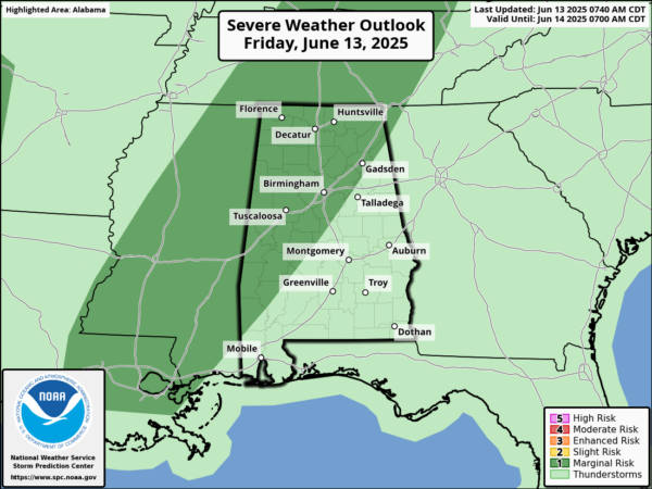
Organized severe storms are not expected, but a random, isolated severe storm cannot be ruled out, and we note the SPC has issued a “marginal risk” (level 1 of 5) of severe storms today for western and northern sections of the state.
Any summer storm can produce strong gusty winds and loads of lightning, with intense tropical downpours, which could allow for isolated areas of flash flooding. In the summertime, there is no way of knowing when and where showers and storms will develop, as they are rather random. You just have to watch radar trends each day.
Highs each day will be in the mid to upper 80s and dew points in the mid 70s for many locations. That is air you can wear and will make it downright uncomfortable at times this weekend.
BIRMINGHAM ALMANAC: For June 13th, the average high for Birmingham is 88° and the average low is 68°. The record high is 99° set in 1977, while the record low is 49° set in 1985. We average 0.15” of precipitation on this date and the record value is 2.23” set in 1912.
NEXT WEEK: Not much change; pretty routine June weather, except higher than normal rain chances. Expect partly sunny, humid, very warm days with scattered, mostly afternoon and evening showers and thunderstorms on a daily basis. Highs will be in the mid to upper 80s. By the end of the week, an upper ridge tries to build in over the region, which should allow for rain chances to decrease and afternoon temperatures to increase Highs by the end of the week look to climb into the lower 90s.
IN THE TROPICS: All is quiet and no tropical storm or hurricane development is expected in the Gulf of Mexico, Caribbean Sea, or the rest of the Atlantic the next seven days.
WORLD TEMPERATURE EXTREMES: Over the last 24 hours, the highest observation outside the U.S. was 122.0F at Jacobabad, Pakistan. The lowest observation was -91.1F at Vostok, Antarctica.
CONTIGUOUS TEMPERATURE EXTREMES: Over the last 24 hours, the highest observation was 114F at Death Valley, CA. The lowest observation was 30F at Mount Washington, NH.
Category: Alabama's Weather, ALL POSTS, Social Media


