Midday Nowcast: Very Muggy with Some Strong Storms Likely
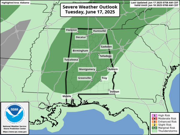
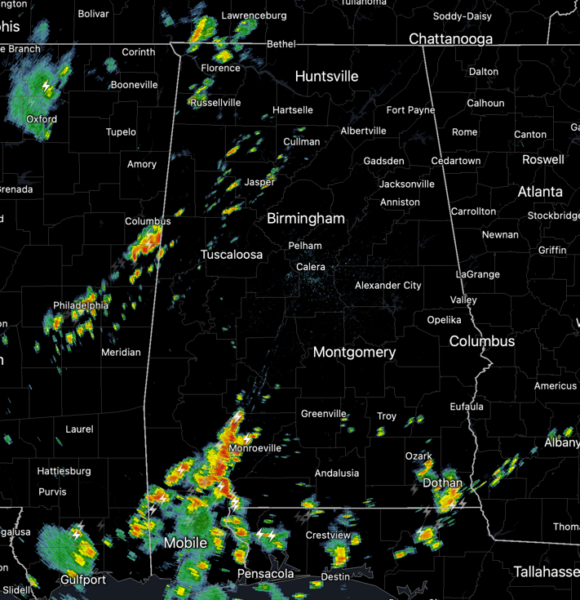
The Storm Prediction Center has introduced a “marginal risk” (level 1 of 5) of severe storms today for much of Alabama. As in recent days, any storms that develop could be strong due to the warm and very muggy conditions providing abundant instability to fuel the storms. The main threat with summer storms will be strong, gusty winds and hail up to one inch in size. Of course, all summer storms produce tremendous amounts of lightning and torrential tropical downpours, which can produce areas of isolated flash flooding. We are seeing a partly sunny sky with afternoon temperatures in the mid to upper 80s. Some storms are beginning to develop and these will increase in coverage through the afternoon and evening hours.
BIRMINGHAM ALMANAC: For June 17th, the average high for Birmingham is 89° and the average low is 69°. The record high is 100° set in 1918, while the record low is 52° set in 1974. We average 0.16” of precipitation on this date and the record value is 2.06” set in 1939.
TOMORROW/THURSDAY: Not much change the next two days in the weather across Alabama. The days will generally start off dry with a partly sunny sky. It will be very warm and humid with highs in the mid to upper 80s each day. During the heating of the day, scattered showers and storms begin to bubble up across the Alabama landscape, usually during the 2PM-10PM timeframe. Organized severe storms are not expected tomorrow, but on occasion, storms will reach severe limits, with strong, gusty winds and hail the main concerns.
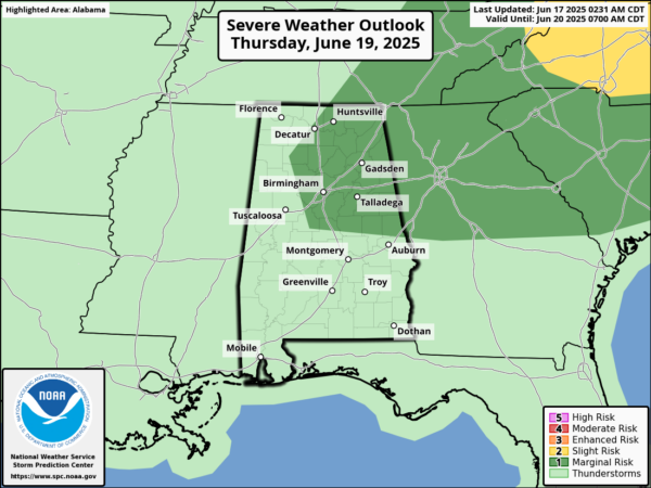
On Thursday, the SPC has highlighted portions of Alabama in yet another risk of severe storms, as storms could be a bit more organized. Rain chances through Thursday will range from 60-80% across the state.
HOTTER TEMPS AHEAD: By Friday and the weekend, an upper ridge begins developing and will bring rising heat levels and a lower coverage of afternoon storms; highs will be in the low to mid 90s and looks to be hottest temperatures so far this year for Alabama and Deep South. Showers and storms will become more isolated in nature with rain chances in the 30-40% range. Heat index values this weekend will like climb into the low 100s for many locations.
NEXT WEEK: For now, fairly routine late June weather for Alabama…partly sunny, hot and humid days, with highs in the low to mid 90s. Each day will continue to feature random, scattered, mainly afternoon and evening showers and storms.
IN THE TROPICS: All is quiet and no tropical storm or hurricane development is expected in the Gulf of Mexico, Caribbean Sea, or the rest of the Atlantic the next seven days.
WORLD TEMPERATURE EXTREMES: Over the last 24 hours, the highest observation outside the U.S. was 124.3F at Kuwait International Airport, Kuwait. The lowest observation was -96.0F at Amundsen-Scott South Pole Station, Antarctica.
CONTIGUOUS TEMPERATURE EXTREMES: Over the last 24 hours, the highest observation was 121F at Stovepipe Wells and Death Valley, CA. The lowest observation was 29F at Mackay, ID.
Category: Alabama's Weather, ALL POSTS, Social Media
About the Author (Author Profile)
Macon, Georgia Television Chief Meteorologist, Birmingham native, and long time Contributor on AlabamaWX. Stormchaser. I did not choose Weather, it chose Me. College Football Fanatic. @Ryan_StinnetSubscribe
If you enjoyed this article, subscribe to receive more just like it.


