Alabama 811 | Know What's Below.

Blog Archives

Wind/Rain For Alabama Tonight; Severe Storms Possible Near The Coast

Wind/Rain For Alabama Tonight; Severe Storms Possible Near The Coast

| January 24, 2023 @ 3:07 pm

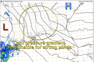
WINDY, WET NIGHT AHEAD: A dynamic weather system will bring widespread rain to Alabama tonight, along with strong gradient winds, not related to thunderstorms. There is a chance that unstable air could creep into the southwest corner of Alabama, and SPC maintains an “enhanced risk” (level 3/5) of severe thunderstorms for areas south of a line from Millry to Brewton.

Read More

Windy Day Ahead With Strong To Severe Storms Possible

Windy Day Ahead With Strong To Severe Storms Possible

| January 12, 2023 @ 5:39 am

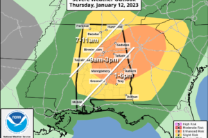
RADAR CHECK: Showers and thunderstorms are forming across Mississippi just before daybreak ahead of a cold front. Storms will enter West Alabama shortly, then progressing through the rest of the state during the day.

Read More

Frost Advisory Tonight; Dry Weekend Ahead

Frost Advisory Tonight; Dry Weekend Ahead

| April 8, 2022 @ 1:38 pm

RADAR CHECK: A few showers are over the northern third of Alabama this afternoon under a deep upper trough rotating through the state. Some sleet and graupel have mixed with the rain in spots across the Tennessee Valley due to the very cold air aloft. Otherwise, the sky is mostly cloudy over North Alabama, with a partly to mostly sunny sky for the southern counties of the state.

Read More

Windy, Cool April Day; Frost Tomorrow Morning

Windy, Cool April Day; Frost Tomorrow Morning

| April 8, 2022 @ 5:49 am

BLUSTERY: West winds will increase later today across Alabama, averaging 15-25 mph with higher gusts. A disturbance will bring some clouds into the state, along with a few spotty showers this afternoon mainly along and north of I-20. Temperatures won’t get out of the 50s over North Alabama, and some spots across the Tennessee Valley might even hold in the 40s all day.

Read More

Windy And Cool; Rain At Times

Windy And Cool; Rain At Times

| October 28, 2021 @ 5:44 am

HANG ON TO YOUR HAT: As expected, it is a very windy morning across Alabama. Gradient winds (not related to thunderstorms) are gusting to 30/40 mph in spots, and a wind advisory remains in effect. The wind will die down later today as the gradient relaxes. Showers continue as a deep upper low evolves just northwest of Alabama this morning. A dry slot will likely bring a little sun later this morning, but clouds will wrap back into the state this afternoon.

Read More

No Rain Through Early Next Week; Heat Levels Rising

No Rain Through Early Next Week; Heat Levels Rising

| May 20, 2021 @ 2:59 pm

SUNNY MAY DAYS: A strong upper high over the eastern third of the U.S. will keep Alabama’s weather rain-free through the weekend. With a mostly sunny sky this afternoon, temperatures are mostly in the low to mid 80s, very close to seasonal averages. Gusty east/southeast winds continue across the state due to a tight pressure gradient; they will die down after sunset. Tonight will be mostly fair with a low in the 60s.

Read More

Hot, Summer-Like Weather Ahead For Alabama

Hot, Summer-Like Weather Ahead For Alabama

| May 20, 2021 @ 5:41 am

BRING ON THE HEAT: A strong upper high will remain anchored over the eastern third of the nation, and will keep Alabama dry through the weekend and most of next week with rising heat levels. Today look for a partly to mostly sunny sky with a high between 83 and 88 degrees. A tight pressure gradient will make for another windy day… southwest winds will gust to 25/30 mph at times.

Read More

Dry Through The Weekend; Heat Levels Rising

Dry Through The Weekend; Heat Levels Rising

| May 19, 2021 @ 3:23 pm

THIS AFTERNOON: We have a party sunny sky across Alabama this afternoon with temperatures mostly in the low to mid 80s; the average high for May 19 at Birmingham is 83. Strong southeast winds are gusting to 25/30 mph at times due to a tight pressure gradient over the state, with high pressure to the east, and low pressure to the west.

Read More

Wet, Cold, Windy; Some Snow For North Alabama

Wet, Cold, Windy; Some Snow For North Alabama

| December 10, 2019 @ 5:50 am

SNOW: As cold air deepens over North Alabama, rain will most likely change to light snow before ending late this afternoon and tonight. The change could come as early as 4:00 to 6:00 over the northwest corner of the state, but the main window comes from 6:00 p.m. until 3:00 a.m. Snow accumulation potential will be limited by the warm ground, but some grassy areas could see 1/2 to 1 inch in spots north of U.S. 278 (north of a line from Hamilton to Cullman to Gadsden). Roads will be just wet tonight with no travel impact; surface temperatures will be in the mid 30s.

Read More

Windy,  Much Colder Today

Windy, Much Colder Today

| December 2, 2019 @ 5:51 am

BLUSTERY MONDAY: A deep upper low is moving through the eastern third of the nation this morning, and will pull much colder air down into Alabama today. We note a few snow flurries on radar over the northeast counties of the state early this morning, but temperatures are above freezing, and there will be no impact. Look for a mix of sun and clouds today; temperatures won’t get out of the 40s, and they hold in the 30s all day over the Tennessee Valley of far North Alabama. A brisk northwest wind of 10-20 mph will make it feel colder.

Read More

Windy And Very Cold Today; Record Lows Early Tomorrow

Windy And Very Cold Today; Record Lows Early Tomorrow

| November 12, 2019 @ 5:43 am

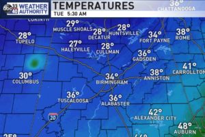
WINDY AND COLD: The Arctic cold front continues to push southward through Alabama this morning; just before daybreak light rain was mainly south of I-59, and it will continue to end from northwest to southeast. As expected, there is some sleet and freezing rain on the back side of the precipitation shield, and also as expected, there is no impact.

Read More

Windy Day; Occasional Showers/Storms

Windy Day; Occasional Showers/Storms

| October 26, 2019 @ 6:31 am

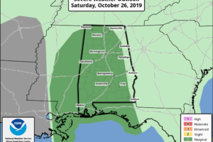
Here is a look at what to expect across Alabama today… WINDY: A wind advisory is in effect for most of the state today. Keep in mind a tropical storm (Olga) moved onto the Louisiana coast overnight; it is now “post-tropical” after merging with the cold front, but a tight pressure gradient will produce southeast […]

Read More

Dry Pattern Through Next Week

Dry Pattern Through Next Week

| April 26, 2019 @ 5:40 am

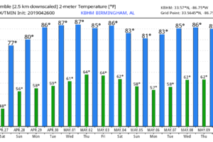
WINDY DAY: Strong northwest winds will develop across Alabama today due to a tight pressure gradient; they will average 15-25 mph this afternoon with higher gusts. Those winds will pull in drier into the state, and the sky will become sunny today… the high will be in the 72-75 degree range. The average high for April 26 at Birmingham is 77.

Read More

Strong/Severe Storms Possible Late Tomorrow/Tomorrow Night

Strong/Severe Storms Possible Late Tomorrow/Tomorrow Night

| March 13, 2019 @ 3:27 pm

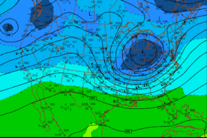
MILD, WINDY AFTERNOON: Temperatures are in the 70s across the great state of Alabama this afternoon with a mix of sun and clouds. While our weather is calm here, we are watching a very deep surface low over Kansas… the pressure has dropped to 972 mb, or 28.70″ of mercury. A blizzard is in progress at Denver; winds at DIA have gusted to 80 mph. Blizzard warnings are in effect across the High Plains, and south and east of the surface low, in the warm sector, showers and storms continue to develop.

Read More