Strong/Severe Storms Tomorrow; Very Cold Next Week
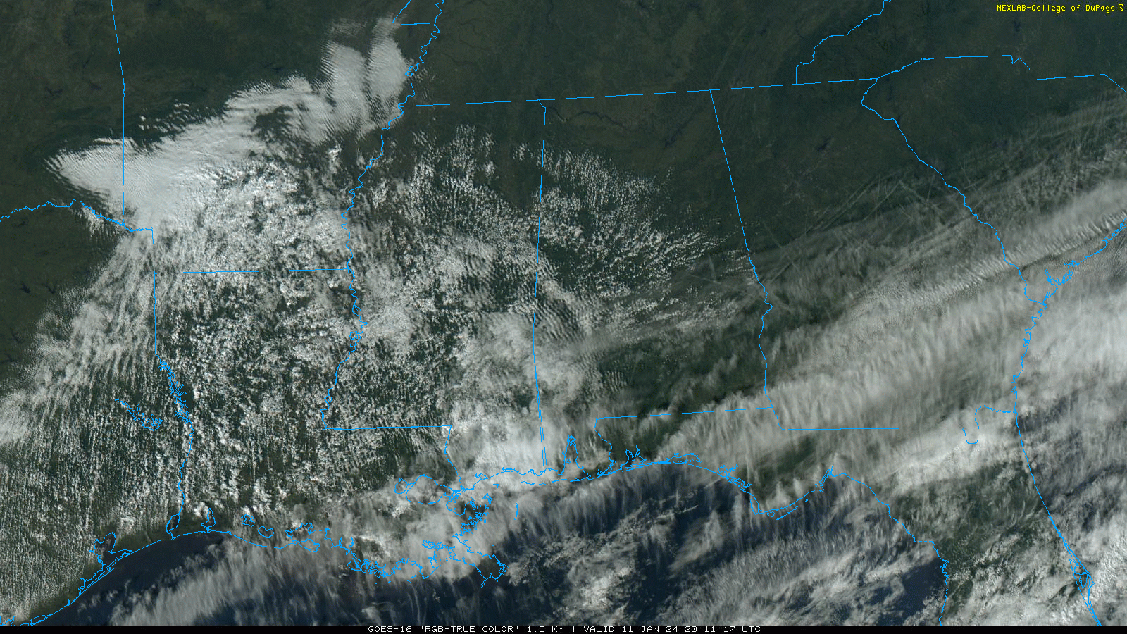
VERY PLEASANT WINTER DAY: Temperatures are in the 60s across Alabama this afternoon with a partly to mostly sunny sky. Clouds will increase tonight ahead of an approaching storm system.
TOMORROW: SPC made some significant changes to the severe weather outlook for Alabama tomorrow on the midday update. We now have an “enhanced risk” (level 3/5) of severe thunderstorms across the northwest part of the state, with a “slight risk” (level 2/5) elsewhere.
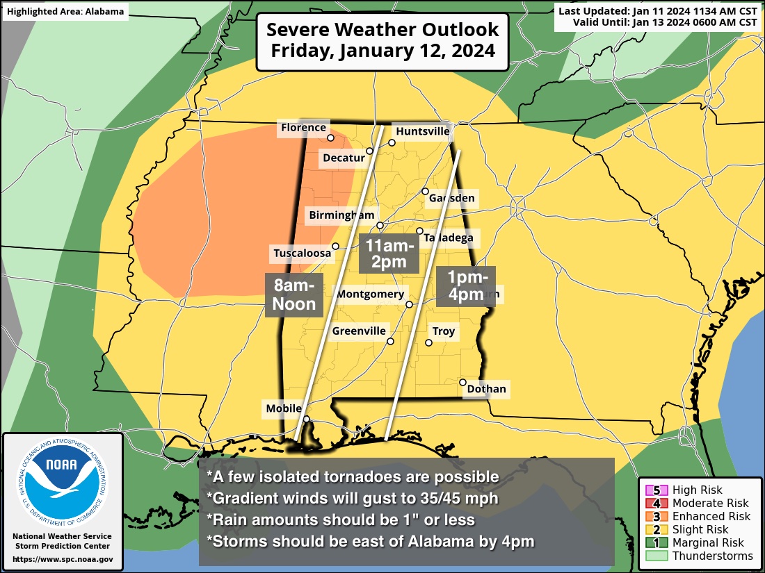
The lack of surface based instability is the primary reason for the change; the overall tornado threat has been lowered. The “enhanced risk” across Northwest Alabama is for potential for strong winds with a line of storms that will pass through that part of the state tomorrow morning.
Here are the key messages for the event tomorrow…
*This will be a daytime event. The risk opens up around 8:00 a.m. for the western counties; storms should be out of the state by 3-4 p.m.
*Storms that form tomorrow will be capable of producing strong, damaging straight line winds, hail, and a few isolated tornadoes. The core threat of isolated tornadoes is south of I-20, where instability values will be higher.
*Gradient winds (non-thunderstorm) will gust to 35/45 mph tomorrow, and a wind advisory is in effect. Not as intense as Monday night, but still a few weakened trees could come down along with some power outages.
*Rain amounts will be under one inch, and flooding is not expected.
As always, be sure you have a reliable way of hearing warnings (NEVER an outdoor siren), and in your safe place have helmets for everyone. If you live in a mobile home, know the location of the nearest shelter, how to get there quickly, and have transportation arranged.
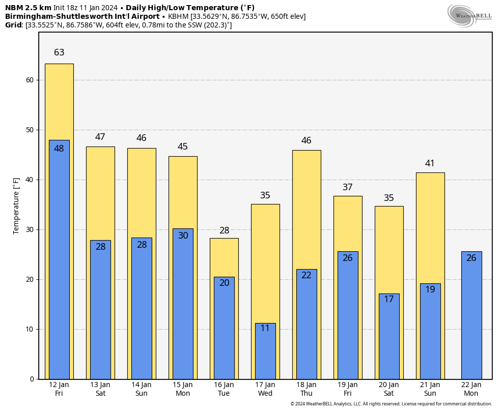
THE WEEKEND: The weather will be dry and colder over the weekend. Morning lows will be in the 23-32 degree range, with highs in the 40s over North Alabama, with 50s for the southern counties Saturday and Sunday.
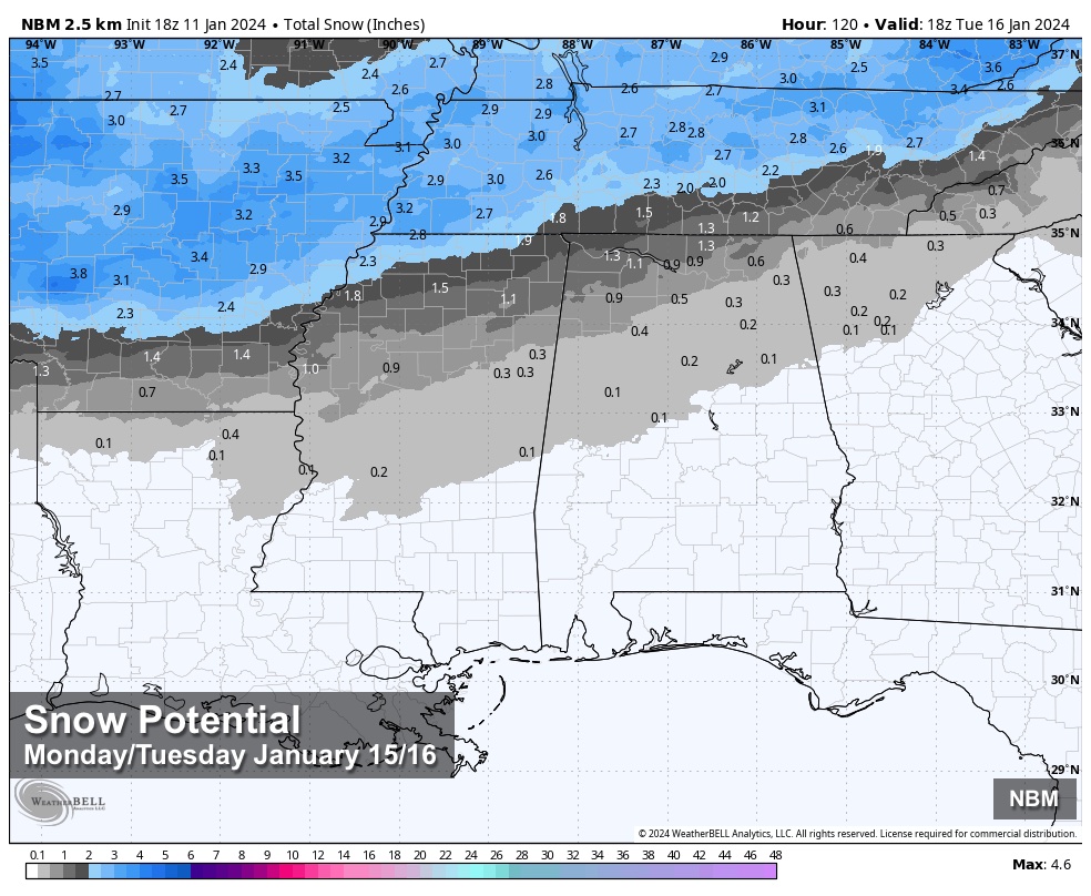
ARCTIC BLAST NEXT WEEK: The coldest air so far this season rolls into the Deep South early next week. Global models continue to suggest some accumulating snow is possible over the northern third of Alabama Monday afternoon, Monday night, and early Tuesday morning. It is still too early for a specific forecast of any potential accumulation or travel impact; once we get tomorrow’s system out of here we can focus this event.
We can tell you with confidence it will be very cold next week. Most of the state will stay well below freezing all day Tuesday, and by Wednesday morning lows will drop into the 10-15 degree range over the northern half of the state, with teens all the way down to near I-10. Some communities across the Tennessee Valley could drop into the single digits. This will be similar to the cold wave we experienced in December 2022. See the video briefing for maps, graphics, and more details.
ON THIS DATE IN 1918: A powerful area of low pressure brought snow and bitterly cold temperatures to Chattanooga, Little Rock, and Shreveport. Birmingham picked up an inch of snow. In far southeastern Alabama, an estimated F3 tornado virtually damaged every building in the town of Webb. The tornado leveled one rural school, killing one teacher and seven students.
ON THIS DATE IN 2021: Accumulating snow affected Pickens, Lamar, Fayette, Walker, Marion, and Winston counties in West Alabama. Reported snow totals were generally in the 1 to 2 inch range, with isolated amounts of up to 3 inches.
Look for the next video briefing here by 6:00 a.m. tomorrow…
Category: Alabama's Weather, ALL POSTS, Weather Xtreme Videos
About the Author (Author Profile)
James Spann is one of the most recognized and trusted television meteorologists in the industry. He holds the AMS CCM designation and television seals from the AMS and NWA. He is a past winner of the Broadcast Meteorologist of the Year from both professional organizations.Subscribe
If you enjoyed this article, subscribe to receive more just like it.


