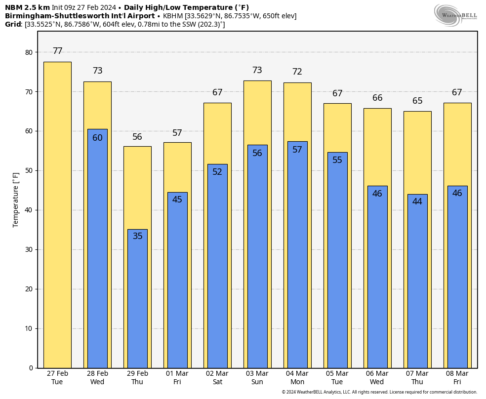
Warm, Windy Day Ahead; Much Colder Tomorrow
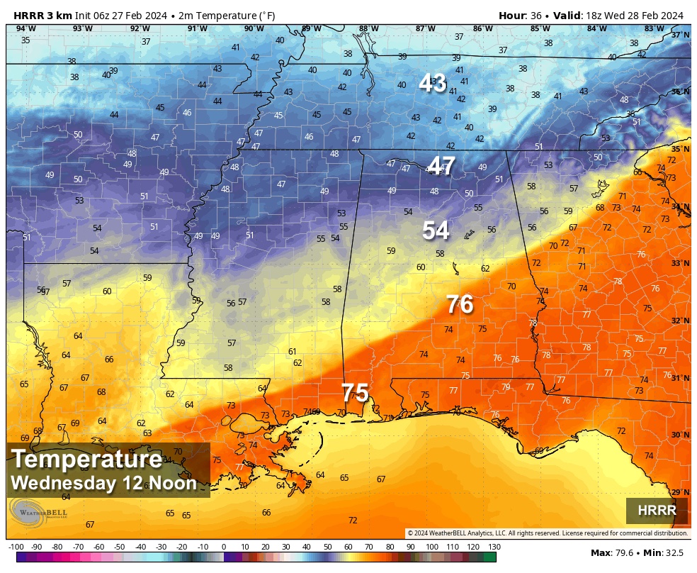
RADAR CHECK: We have large areas of light rain moving across North/Central Alabama early this morning… otherwise the sky is mostly cloudy with temperatures in the 60s. We project a high in the 75-80 degree range later today; most of the afternoon should be dry and the sun could peek out at times. Winds will begin to ramp up as well; a wind advisory is in effect for the northern 2/3 of the state through tomorrow morning. Gradient winds (not related to thunderstorms) could gust to 40 mph in spots by tonight.
TOMORROW: A cold front will bring a sharp weather change to the Deep South. Periods of rain are likely, but there is no risk of severe storms. Much colder air will follow the front; many communities across the Tennessee Valley of North Alabama will hold in the 46-52 degree range all day with a brisk north wind. For the central counties, temperatures will begin to fall by mid to late morning, settling into the low 50s through the afternoon. And, South Alabama will see another day with highs in the 70s, but even there colder air moves in by mid to late afternoon.
THURSDAY/FRIDAY: Thursday will be a cool, dry day with highs in the 50s. But, rain returns to the state on Friday with a fast moving disturbance. This will be a cool rain with temperatures holding in the 50s again through most of the day.
THE ALABAMA WEEKEND: We project a warming trend over the weekend, with highs in the 65-73 degree range Saturday, and in the 70s statewide Sunday. A pool of moist air will remain in place, and a few showers are possible both days. But, nothing too widespread or heavy; the weekend certainly won’t be a wash-out. The sky will be generally cloudy.
NEXT WEEK: Another cold front will approach early in the week, and showers and a few thunderstorms are likely in the Monday-Tuesday time frame. Global models are not in very good agreement concerning the details, but a strong storm is certainly possible with this event. Drier air returns to the Deep South by Thursday and Friday. See the video briefing for maps, graphics, and more details.
ON THIS DATE IN 1986: It was 99 degrees in Palm Springs, California, the highest temperature on record for February. Palm Springs also reached 99 degrees on February 26, 1986.
ON THIS DATE IN 1999: Severe thunderstorms moved through Alabama on February 27, 1999… a few tornadoes touched down as well, including an EF-2 near Locust Fork in Blount County. Most of the the damage across the state was due to straight line winds.
Look for the next video briefing here by 3:00 this afternoon… enjoy the day!
Category: Alabama's Weather, ALL POSTS, Weather Xtreme Videos
About the Author (Author Profile)
James Spann is one of the most recognized and trusted television meteorologists in the industry. He holds the AMS CCM designation and television seals from the AMS and NWA. He is a past winner of the Broadcast Meteorologist of the Year from both professional organizations.Subscribe
If you enjoyed this article, subscribe to receive more just like it.


