Midday Nowcast: Strong and Some Severe Storms Expected Later Today
Click image to enlarge.
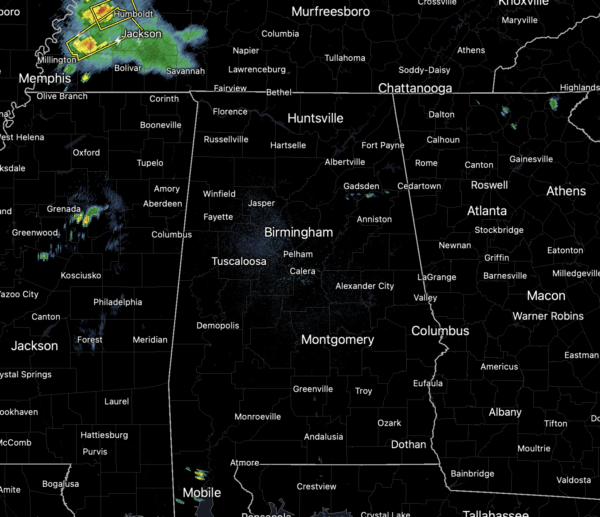
The radar across Alabama is fairly quiet right now, but that will change as we head through today. Expect periods of rain and storms the rest to today and tomorrow. Storms will be strong, and we could see several severe storms across Alabama. In fact, nearly all of Alabama is under some sort of severe weather risk through tomorrow morning, with the highest risk of severe storms over the northern third of the Alabama (along and north of Interstate 20).
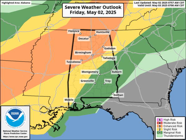
Stronger storms today will be capable of producing damaging wind gusts and severe hail, these are the main threats. The tornado threat is very low, but not zero, as the wind fields are not especially strong. However, I am always reminded of what the late, great J.B. Elliott always said, “With storms in Alabama, always expect a surprise of two.” Remain weather aware today and tonight!
Make sure you have reliable ways to receive severe weather alerts if and when they are issued as we are likely see watches and warnings issued for Alabama later today. Along with the severe weather threat, we note storms will be prolific lightning producers and produce brief, tropical downpours which could lead to areas of isolated flash flooding. Temperatures today are in the low and mid 80s for most of North and Central Alabama.
BIRMINGHAM ALMANAC: For May 2nd, the average high for Birmingham is 79° and the average low is 57°. The record high is 92° set in 1901, while the record low is 38° set in 1963. We average 0.16” of precipitation on this date and the record value is 1.95” set in 1964.
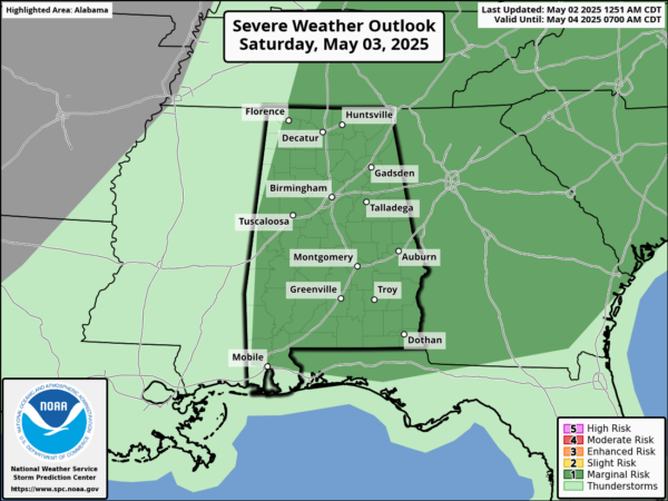
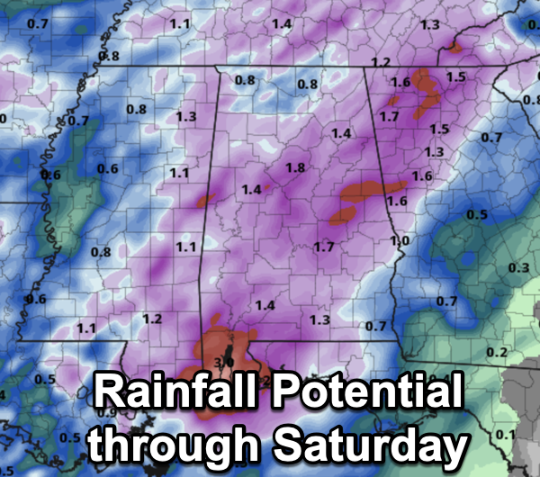
TOMORROW: Rain and storms will remain in the forecast tomorrow as the actual front moves through the state. There remains a low end threat of severe storms, as gusty winds and small hail will be possible, but tomorrow will be cooler with low and mid 70s, so the air will be more stable. Average rain amounts through tomorrow will be in the 1-2 inch range for most of the state.
SPLENDID SUNDAY: The front pushes south and drier air surges south into the state. The sky becomes mostly sunny and after a low in the 50s, Sunday’s high will be in the low to mid 70s for most communities. Sunday night, temperatures will drop well down in the 40s over North Alabama.
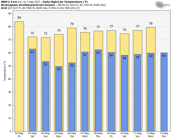
NEXT WEEK: The first half of the week will be dry, with highs will be in the 70s, lows will be in the 50s. The temperatures will warm into the 80s late in the week, and it looks like scattered showers will return to the forecast for the latter half of the week as well.
WORLD TEMPERATURE EXTREMES: Over the last 24 hours, the highest observation outside the U.S. was 116.6F at Jaisalmer, India. The lowest observation was -83.7F at Concordia, Antarctica.
CONTIGUOUS TEMPERATURE EXTREMES: Over the last 24 hours, the highest observation was 104F at Rio Grande Village, TX. The lowest observation was 12F at Peter Sinks, UT.
Category: Alabama's Weather, ALL POSTS, Severe Weather, Social Media
About the Author (Author Profile)
Macon, Georgia Television Chief Meteorologist, Birmingham native, and long time Contributor on AlabamaWX. Stormchaser. I did not choose Weather, it chose Me. College Football Fanatic. @Ryan_StinnetSubscribe
If you enjoyed this article, subscribe to receive more just like it.


