Alabama 811 | Know What's Below.

Archive for February, 2013

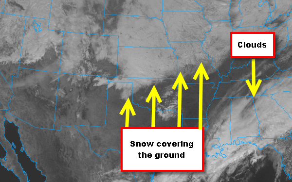
Snow Showing up on Satellite

Snow Showing up on Satellite

| February 23, 2013 @ 4:08 pm

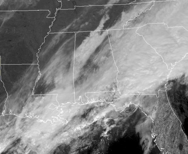
The winter storm that affected the Plains and the Midwest this week, left quite the mark on the country. Snow fall blanketed many location and many areas received over a foot of snow. This afternoon the snow is showing up on the visible satellite image. Across the Southeast a stalled front is allowing for continued […]

Read More

Rain Moving onto Gulf Coast

Rain Moving onto Gulf Coast

| February 23, 2013 @ 2:35 pm

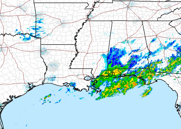
A stalled frontal boundary along the Gulf Coast continues to provide the uplift for persistent showers and thunderstorms along the Interstate 10 corridor this weekend. Over the last few hours more areas of rain have moved onshore into Mobile and Baldwin Counties. Not expecting the rain to make it into North Central Alabama, but some […]

Read More

Drought Conditions Improving

Drought Conditions Improving

| February 23, 2013 @ 1:32 pm

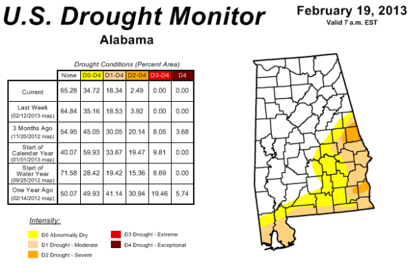
It has been an active and wet weather pattern for much of the winter across Alabama, and this pattern looks to continue. Good thing about all the wet weather is that it is continuing to improve the drought conditions across Alabama. This drought report  is from earlier this week and actually the portions of the […]

Read More

Clearing to Our West

Clearing to Our West

| February 23, 2013 @ 11:45 am

Looking at the latest satellite image, there are a few breaks in the clouds in portions of Central Alabama. Much more clearing in Northwest Alabama and back in North Mississippi and full sun back in Arkansas and Louisiana. Areas around Muscle Shoals and Red Bay have sun already, and clouds should be slowly moving out […]

Read More

The Scottish Inn Tornado (1975)

The Scottish Inn Tornado (1975)

| February 23, 2013 @ 10:30 am

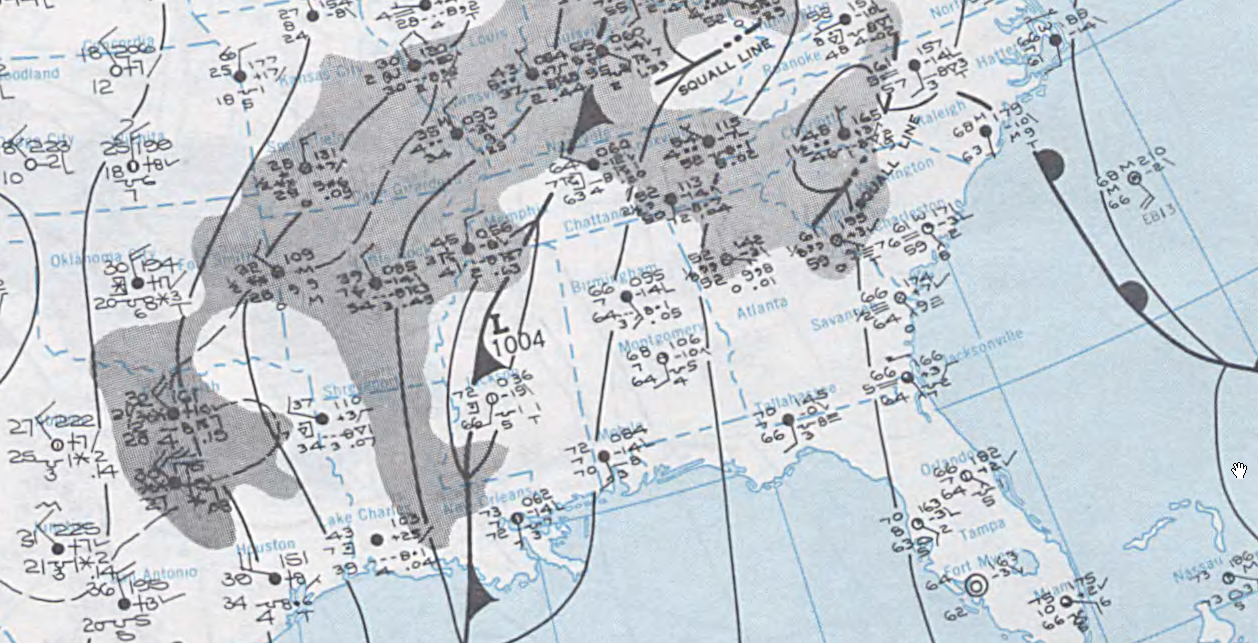
Weather maps on the morning of Sunday, February 23, 1975 showed a low pressure system over North Central Mississippi. The low was not very strong. At 6 a.m. that morning, the pressure in the low was only 1004 mb. A warm, moist airmass was in place across Alabama, with temperatures across the central part of […]

Read More

One Nice Day

One Nice Day

| February 23, 2013 @ 7:15 am

An all new edition of the ABC 33/40 Weather Xtreme video is available in the player on the right sidebar of the blog. You can subscribe to the Weather Xtreme video on iTunes by clicking here. We can put away the plans for the ark for at least today and Sunday as we dry out […]

Read More

More Showers and Storms

More Showers and Storms

| February 22, 2013 @ 6:12 pm

More showers and storms are moving back into North Central Alabama this evening. Heavy rains last night moved out and most of today was dry, but cloudy. Now another energy impulse is moving across the state allowing for additional showers and thunderstorms to develop across much of the region. We have seen a few strong […]

Read More

Severe Thunderstorm Warning: Southern Marengo County

Severe Thunderstorm Warning: Southern Marengo County

| February 22, 2013 @ 3:17 pm

UPDATE 3:30 Here is a four panel depiction of radar products of the storm in Marengo County with a brief explanation of what they indicate. The path is more clearly indicated as well. The storm is moving at nearly 60 mph. The NWS has issued a severe thunderstorm warning for the southern half of Marengo […]

Read More

More Rain For Alabama Tonight

More Rain For Alabama Tonight

| February 22, 2013 @ 3:09 pm

An all new edition of the ABC 33/40 Weather Xtreme video is available in the player on the right sidebar of the blog. You can subscribe to the Weather Xtreme video on iTunes by clicking here. RAIN MOVING BACK IN: Rain has re-entered West Alabama this afternoon, and that rain will expand to the east […]

Read More

How Wet Is It?

How Wet Is It?

| February 22, 2013 @ 8:57 am

If you think February in Central Alabama has been wet, I would agree with you. But it really hasn’t been that wet for some of us. Looking at the climatological reports for Central Alabama, nearly everyone is above the average monthly rainfall with the exception of Anniston. I’ve assembled some data on the rainfall reported […]

Read More

More Rain Tonight; Mostly Dry This Weekend

More Rain Tonight; Mostly Dry This Weekend

| February 22, 2013 @ 5:56 am

An all new edition of the ABC 33/40 Weather Xtreme video is available in the player on the right sidebar of the blog. You can subscribe to the Weather Xtreme video on iTunes by clicking here. RADAR CHECK: The big rain mass that was over our part of the state last night is now well […]

Read More

Debris Signature on Storm in South Mississippi

Debris Signature on Storm in South Mississippi

| February 21, 2013 @ 10:47 pm

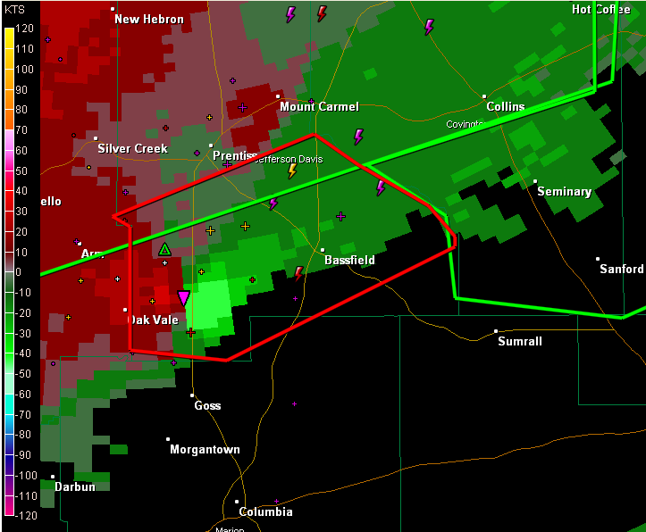
There is a dangerous storm over southern Mississippi tonight about 30 miles northwest of Hattiesburg. It shows strong indications of a tornado. The most dangerous part of the storm is near Bassville community. The NWS Jackson see a debris signature now on the Doppler Radar. It will pass near or just south of Laurel in […]

Read More

Heavy Rain Falling

Heavy Rain Falling

| February 21, 2013 @ 8:07 pm

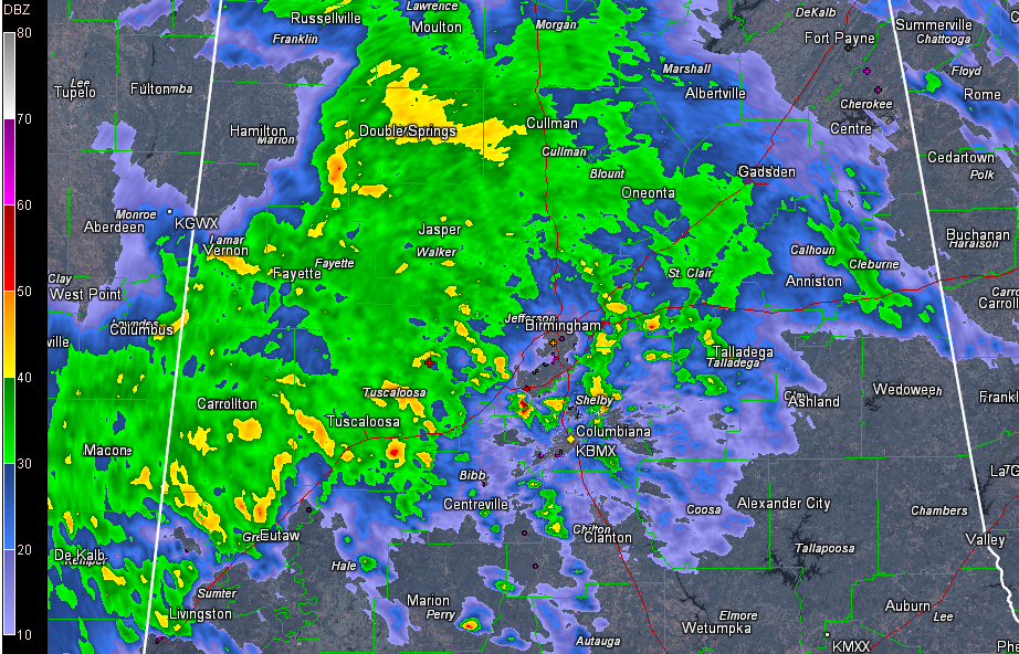
Snoopy started all of his novels with “it was a dark and stormy night.” That would be an appropriate description of tonight’s weather across the northwestern quarter of Alabama with a mass of heavy rain moving northeast and translating slowly east across the area. Nothing severe, just heavy rain. It is raining heavily now in […]

Read More

Wet Evening and Night

Wet Evening and Night

| February 21, 2013 @ 5:17 pm

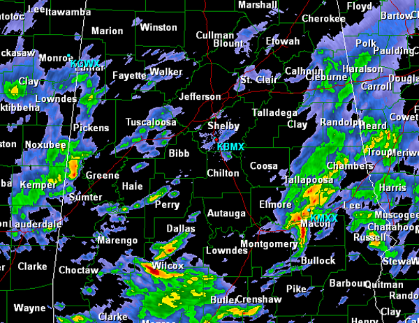
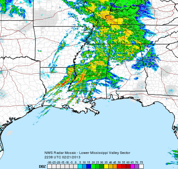
Heavy rain and a few rumbles of thunder have moved into Alabama this afternoon and evening and it is shaping up to be a wet night. Heavy rain is falling mostly along and north of Interstate 20/59. Rain is falling in the Birmingham metro currently and much heavier rain is off to our west in […]

Read More